Customer: Haut Comité Français Défense Civile (HCFDC)
Programme: Risk Management
Supply Chain: HCFDC > CS Group SPACE
Context
Introduction à rédiger
lien vers video
après..
CS Group responsabilities for Geographic platform for planning and decision support for risk management are as follows:
- Provision and support in SaaS mode of a turnkey solution.
- Ergonomics studied for non-specialists.
- Support services included.
The features are as follows:
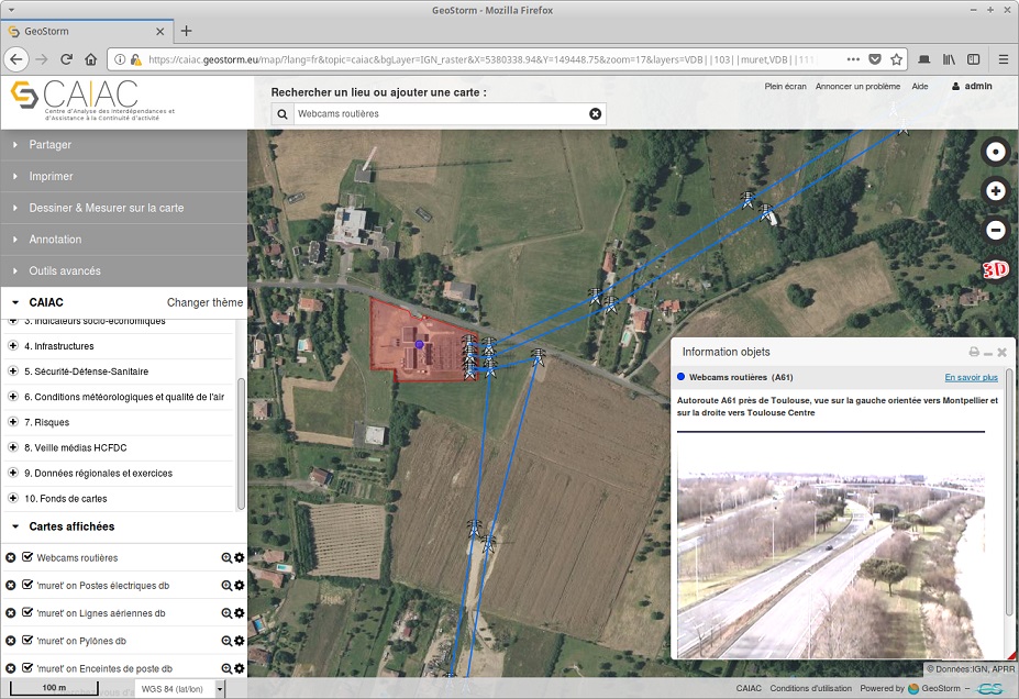
- more than 400 data layers
- Annotation, comparison, layer measurements
- Full text search
- Visualization of the raster, vector layers
- Real-time data visualization
- Storage and management of multidimensional data
- Integration of spatial-temporal data
- Publication of maps
- Product distribution
- Import of external services
- Cataloguing, harvesting
Project implementation
The project objectives are as follows:
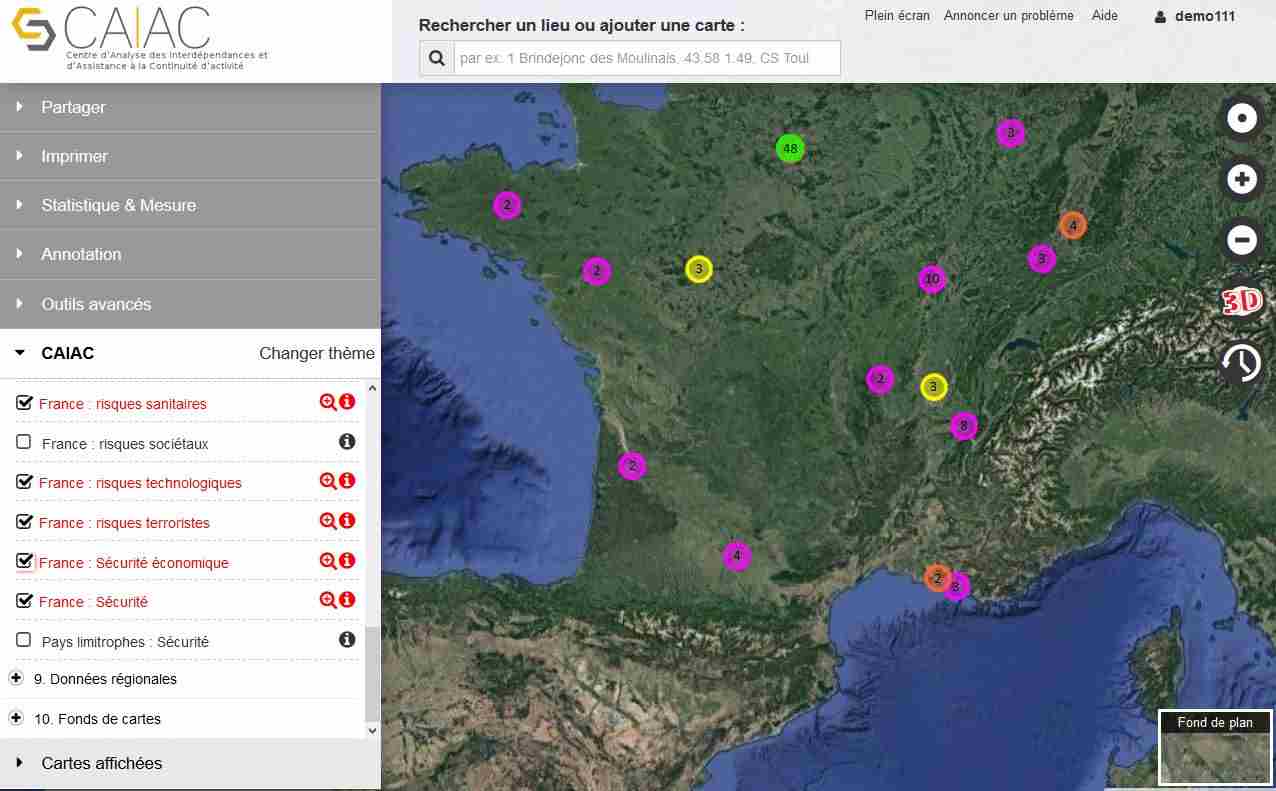
- Deploy a mapping platform to assist critical operators and territorial managers in their planning, decision support, risk and crisis management activities.
- Integrate simulation and information acquisition functions and services into the CAIAC platform
The processes for carrying out the project are:
Technical characteristics
The solution key points are as follows:
- Full web solution hosted on a sovereign cloud (OVH)
- Definition of standards for module input and output
- Architecture of the service bus type
- Scalability and potential for integration of new services
- High reuse of a powerful and extensible base (GEOSTORM).
The main technologies used in this project are:
| Domain |
Technology(ies) |
| Operating System(s) |
Linux, WEB client |
| Programming language(s) |
HTML5, Javascript, Python |
| Interoperability (protocols, format, APIs) |
WMS, WFS, WMTS, WPS, CSW, BPMN, UML, LDAP, ISO 119115, 19139, Opensearch |
| Production software (IDE, DEVOPS etc.) |
Git, Docker, Jenkins |
| Main COTS library(ies) |
GEOSTORM, Angular JS 1.2.x, OpenLayers 3, Django, DRF, QuantumGIS, WebGL, Postgresql 9.x, Postgis, Elastic search |
