Customer: Direction Générale de l’Armement (DGA)
Programme: GHOM
Supply Chain: DGA > CS Group SPACE
Context
CS Group responsabilities for Architectural analysis and definition of the Geophysical Environment Information System GEODE 4D are as follows:
- Architectural analysis and system definition
- Functional specification,
- Committing financial proposition,
- Realisation of mock ups and prototypes.
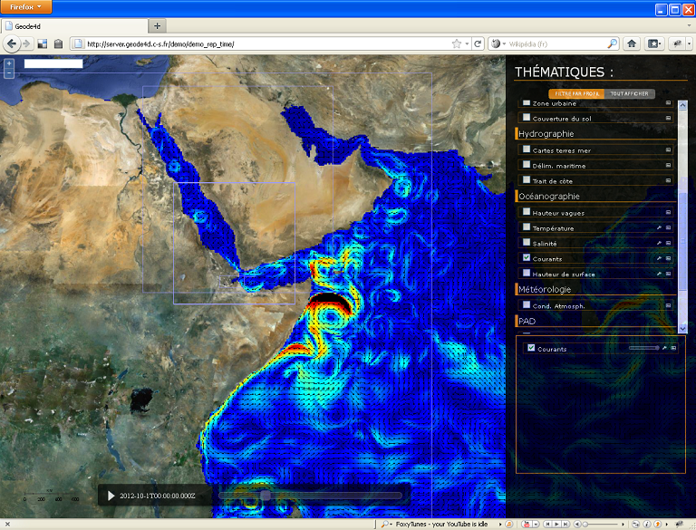
The features are as follows:
- Facilitates access to relevant data
- Insures its job consistency
- Elaborates and spreads the Recognized Environmental Picture (NATO concept)
- Mutualizes the environmental data exploitation, for the whole material and human army means
- Allows to reduce costs, delays and risks for the different programs exploiting these data
- Allows to improve interoperability and exchanges of geophysical environment related information between Defence systems and provide expertize tools and decision-making helping services.
Project implementation
The project objectives are as follows:
- GEODE 4D is a project to set up a geophysical cross forces information system.
The processes for carrying out the project are:
Technical characteristics
The solution key points are as follows:
- Modular and generic architecture design;
- Information Systems technological experience, including each environment-dedicated domain;
- Use of tools and software worldwide known for their efficiency;
- Use of Open-Source components to reduce both ownership and exploitation costs (licences,…).
The main technologies used in this project are:
| Domain |
Technology(ies) |
| Operating System(s) |
Windows seven , xp , Linux debian |
| Programming language(s) |
java, python, javascript |
| Production software (IDE, DEVOPS etc.) |
IBM SA, DOORS, Office 2003 |
| Main COTS library(ies) |
GIS framework (map server, global mapper qgis, thredds), ESRI |
