Customer: Centre National d’Etudes Spatiales (CNES)
Programme: Generic
Supply Chain: CNES > CS Group SPACE
Context
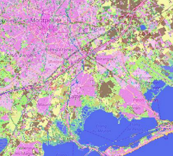
IOTA² is a land-use map production line for large areas based on time series of Sentinel or Landsat images developped for CNES / CESBIO. In order to facilitate methodological contributions, IOTA² is open-source. As such, the channel makes extensive use of the image processing applications provided by Orfeo ToolBox.
CS Group responsabilities for IOTA² - Infrastructure for Land Use by Automatic Treatment are as follows:
- Maintenance and evolution of the IOTA² chain in order to meet the needs of land use map production
- User support

The features are as follows:
- Use of sensors of different types (optical/radar) to obtain better quality classifications
- Users can provide exogenous data as well as primitive data
- Possibility of spatially delineating learning zones
- Automatic calculation of primitives allowing the help to determine the label
- Merging classifications
- Automatic generation of coefficients allowing the evaluation of the quality of the classification
- Division into stages of the chain allows it to be launched only on very specific stages
Project implementation
The project objectives are as follows:
- IOTA² - land-use map production line for large areas based on time series of Sentinel or Landsat images
- Annual production of a national land use map
- Testing new algorithms over large areas
The processes for carrying out the project are:
Technical characteristics
The solution key points are as follows:
- Automatic installation with its dependencies
- Combined use of Orfeo ToolBox multi-threading and MPI speeds up calculations
- Understanding of different N2A product formats (THEIA + PEPS) to be able to classify as many geographical areas as possible
The main technologies used in this project are:
| Domain |
Technology(ies) |
| Operating System(s) |
Unix, Linux Ubuntu, CentOS |
| Programming language(s) |
Python, C++ |
| Production software (IDE, DEVOPS etc.) |
GCC 4.8 |
| Main COTS library(ies) |
OTB, GDAL, Qgis |

